
By Marty Proctor
The city of Groveland is creating and executing a consolidated plan for the future of the city. A presentation at the Centennial Celebration highlighted the future of downtown Groveland and the Florida Department of Transportation (FDOT) state road 50 (SR50) realignment plan.

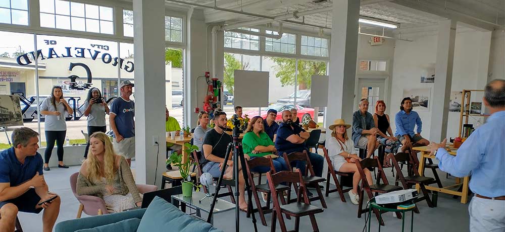
The presentation shared the city view of the planning process as seen by city planners, community leaders, local landowners, and outside experts. The event was hosted by Tim Maslow, the Groveland Community Development Director. He was supported by urban agrarian and modern planning experts like architect Geoffrey Mouen, civil engineer and president of Baytowne Group, Johnny Sims, transportation expert and president of HPE Incorporated, Rick Hall, local land-use lawyer Bret Jones and the city planning staff including Andrew Landis, Brooke Worthington and DeWayne Jones.
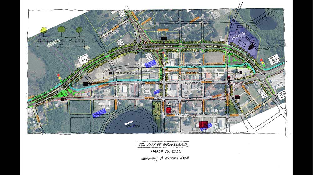
The city is focused on optimizing the FDOT-funded SR50 realignment and the Florida Coast-to-Coast Trail through downtown. Historically cars and pedestrians shared Groveland’s roads. As time passed, the streets of downtown Groveland have become dominated by cars and trucks. While the right of way for the SR50 realignment is being acquired, the city planners want to do quality assurance. “We want to ensure that we address not only the trails and roads but the pedestrian experience,” stated Tim Maslow, Community Development Director. “We want to be totally prepared to create the best experience downtown.”
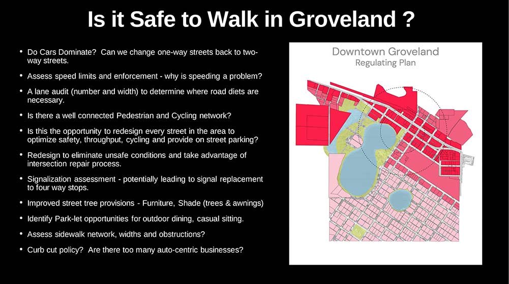
Creating a safe, comfortable and interesting pedestrian experience in Groveland was presented by Mr. Mouen. Living in or visiting downtown today, it may feel that it is unsafe or uncomfortable to walk downtown. The presentation included an 11-step plan to evaluate the types of obstacles preventing safe and comfortable walkability in Groveland. The plan also focuses on whether it is useful and interesting to walk around Groveland today. The plan is addressing all of these challenges starting with a street frontage quality assessment to determine how to create interesting and useful spaces for pedestrians. The city can suggest alterations to the FDOT during this stage of the SR50 plan. The FDOT realizes that the local officials may have local or specific knowledge that is not apparent from the state level. Sharing this local input with FDOT is a value of this type of visioning and public feedback process.
Architect Geoffrey Mouen continued with proposed solutions. Pedestrian structures, benches, shade and rain canopies, and urban green spaces are presented as street-level enhancements. “Urban green spaces with individual trees with places for enough water to go to support single trees” throughout the downtown. He also supported adding trees to the side and center of the SR50 realignment plan. “Trees provide a solid object between the vehicles and pedestrians as well as distraction to slow down drivers.”
Rick Hall, a professional engineer and recognized transportation expert, presented next. The city is proposing several street changes to the FDOT SR50 realignment plan. Mr. Hall proposed using the DOT’s own roadway categorization system to match up the land use and transportation elements. This is a way to request modification of the DOT plan using their own language for a greater likelihood of success. These changes may include modifying or eliminating streets and traffic control devices like stoplights. These alterations will enable the city and business owners to upgrade facades, sidewalks and public spaces. All with the goal of making the downtown area safer and more comfortable, interesting, and useful to residents and visitors.
The entire city land development regulations, comprehensive plan and future land use maps have been rewritten. The city created a form-based code to help developers understand the expectations as they design and create new developments in Groveland. Not plans or goals, these are changes the city has already executed within the city’s ordinances. The new codes and ordinances have been determined to be legal and enforceable and are the core of the methodology behind developing the Lake Catherine Blueberry Farm using agrarian urbanism concepts.
The city is a county-wide trailblazer implementing these modern planning concepts. Tim Maslow commented, “We intend to use this transportation context approach for the whole city-not just the downtown. We are about to start working on a Joint Planning Agreement (JPA) with Lake County.” Talking about this in the wider JPA context beyond downtown, he explained the need to: “address major arteries. Villa City Road, Cherry Lake Road and others in need of attention because so much growth is coming.” And repeating, “we want to be totally prepared to create the best experience downtown.”
")

